The level of the sea is increasing rapidly: what will Slapton Sands look like within the next 80 years?
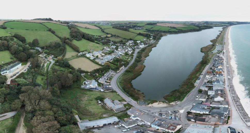
VISTA’s teams have been working for several months with our partner from the South West Coast Path on a visual reconstruction of what Slapton Sands – Torcross site – should look like by the end of the century, if sea levels continue to rise at this rate, focusing on two key moments in the future: 2050 and 2100.
Rising water levels will drastically change the appearance of this part of the ley, as well as have an impact on the biodiversity.
In 2050, the waters will break in the street and turn the ley into marshland giving rise to an open bay in 2100.

Among the various projects underway, we are currently working on the creation of a mobile application through which the user will be able to see the static reconstruction of the landscape at these two periods and immerse oneself in the scene to become fully aware of the impact of climate change on this magnificent landscape.
Because we are always happy to share with you the progress of our work, here is the very first testing prototype of this application.

While waiting to learn more about the evolutions of this device, lovers of seaside walks and hikes are invited to come and visit this site (in compliance with the security measures due to COVID-19). Regular visitors, you are probably aware that a minor deviation was installed last year following storm Emma. We hope that thanks to the development of the English Coastal Road, which is expected to be completed in 2020, this area can be mended and reopened quickly.

For more information about Slapton, here is a link that might be of interest to you: http://www.slaptonline.org/